Power line inspection

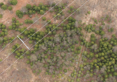
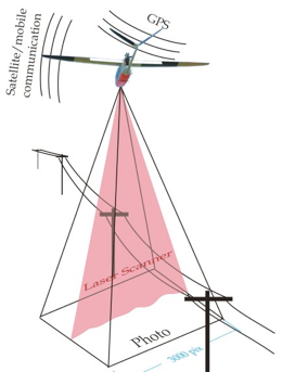
A payload combination of digital camera and laser scanner can be used to map the vegetation growth in the power line corridors.
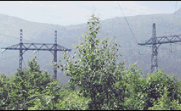
Mapping of power line corridors with a UAS will allow us to accurately position the power poles and measure the distance from the power lines to the surrounding vegetation. Threes falling and tearing down the lines in connection with severe weather is the main source of power outages today.
It is also possible to identify icing problems with high resolution camera or to detect problem components using radio noise measurements and IR-cameras.
- Less expensive and faster than use of helicopter or ground based inspections
- The inspection is documented by data and images
-
-This reduces the risk for having to pay compensations (KILE) to the customers
For more information:
Please contact us on e-mail: uav@norut.no