Mapping

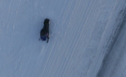
An abandoned snowmobile outside Longyearbyen mapped with the UAS
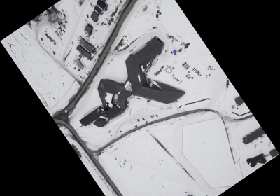
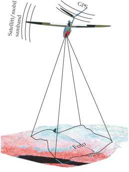
By using a common high resolution digital SLR camera and performing corrections for optical distortions we can map 75 square kilometer at 15 cm ground resolution. With the help of differential GPS post processing and an accurate DEM, an absolute ground positioning accuracy close to 1 meter can be achieved without using ground control points.
Possible applications are:
- Document damage from off road vehicles
- Population counts of animals like seals, reindeers, polar bears etc.
- Maps for planning and documentation
- Mapping of sea ice concentrations and the ice edge
For more information:
Please contact us on e-mail: uav@norut.no