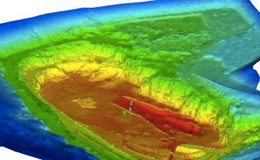
Digital elevation models

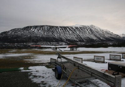
UAS equipped with a laser scanner can be used to construct surface elevation maps with one meter horizontal resolution and 10 cm vertical accuracy
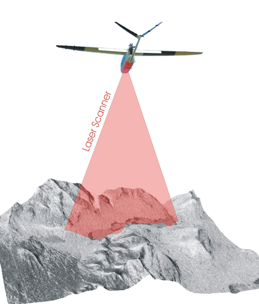
Norut have laser scanners specially built for the CryoWing UAS. The scanner samples 25000 points per second and up to 30 sweeps per second. This give a maximum ground resolution of about 1 m along track and 20 cm across track, depending on flight altitude.
The CryoWing laser scanner has the following desirable properties:
- Less expensive than manned aircraft options
- More accurate than ortho photo stereography
- Up to 25000 points per second
Possible applications for a digital elevation model derived from a UAV:
- Glacial mass balance and surface elevation mapping
- Biomass growth rate in forestry
- Roughness maps in connection with wind parks
- Measure wave heights and lengths
For more information:
Please contact us on e-mail: uav@norut.no